BozoBrody
Well-Known Member
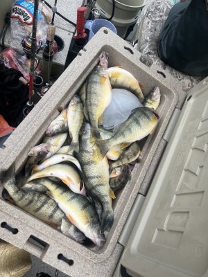
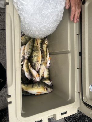
Was talking to a group of Americans last night at the marina, they ended up with 134 jumbos down off Hastings. 30-40 fow. Said the muddy water went out to 25fow. The perch are still out there
Could it be that Hastings is alive again ??????? I can only dream of the good old days For those that experienced it back must be 10 years ago now i've lost count but it was epicWas talking to a group of Americans last night at the marina, they ended up with 134 jumbos down off Hastings. 30-40 fow. Said the muddy water went out to 25fow. The perch are still out there
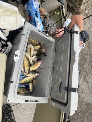
Big otter marina has them, another 3 man limit from Hastings came in todayAre minnows available in Burwell
What he said ^. Long @ss ride. Feast or famine. But if it’s on….. bucketloads!Ok, where is this??
Like they said up there^^^ east of the Sandhills. Takes about half an hour to 40 minutes or more to get there from Burwell depending on conditions, the boat and what's pushin it through the water.Ok, where is this??
We get it, advertisements are annoying!
Advertising is what keeps Channel 6-8 on the air. To this end, please take a moment to disable your AdBlocker. If you would prefer an ad-free experience, but would still like to help support site operations, please consider making a donation.