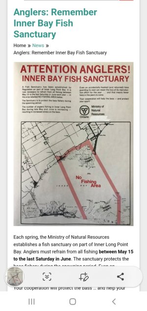
The full definition of the sanctuary area from the Ontario Fishery Regulations (not the regs summary) is as follows:
The waters of that part of Lake Erie in the townships of Delhi and Norfolk, in the Regional Municipality of Haldimand-Norfolk, being composed of all the waters of Inner Bay of Long Point Bay, including all waters joining said Inner Bay lying within the following limits: commencing at the intersection of the water’s edge of Inner Bay of Long Point Bay with the westerly limit of Lot 1, Concession B, as shown on the plan of the Township of Charlotteville; thence northerly along that westerly limit to the intersection with the easterly limit of the right-of-way of Haldimand-Norfolk Region Road Number 16; thence northerly along that easterly limit to the intersection with the southerly limit of the right-of-way of the travelled road known locally as Front Road; thence easterly along that southerly limit across Lots 1 to 10 inclusive, Concession B, as shown on the plan of the Township of Charlotteville, to the intersection with the northwesterly production of a line joining a control survey monument, indexed with the Ontario Ministry of Natural Resources and Forestry as station 008750128, located on the northerly extremity of Pottahawk Point, 42°36′35.76073″N., 80°17′10.00336″W. and a control survey monument, indexed with the Ontario Ministry of Natural Resources and Forestry as station 008750127, located on the lands of the Turkey Point Marina, 42°39′57.40627″N., 80°19′52.25129″W.; thence southeasterly along the northwesterly production and the line to the said control survey monument on Pottahawk Point; thence south astronomically to the water’s edge along the southerly shore of Long Point; thence westerly along that water’s edge to the intersection with a line drawn on a course of south 26°00′ east from the place of beginning; thence north 26°00′ west along that line to the place of beginning.
Simple :-P
The definition hasn’t changed and the old maps above are still correct. The “one rod” rule hasn’t changed. The boundary of the inner bay, as pertains to the one rod rule is as follows:
(b) Inner Bay of Long Point Bay, including the waters west of a line drawn from Turkey Point Marina at 42º39′57.4″ N, 80º19′52.5″ W to Pottawhawk Point at 42º35′35″ N, 80°17′10.0″ W;

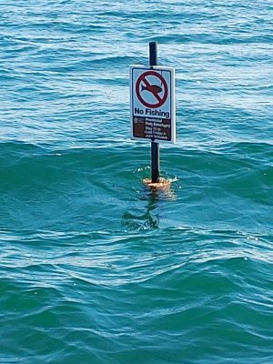
 I remember seeing those signs before COVID.


