Edmcl
Well-Known Member
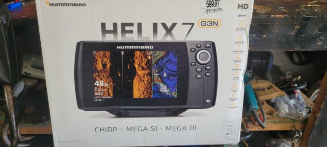
Had an opportunity to put the helix 7 fishfinder GPS chart plotter in the fishing boat chirp mega SI mega DIG3N version. I have always used garmin Lawrence. And this one is getting me to scratch my head. The unit out of the box needs to be upgraded. As the topographical map of Lake, Erie is showing a top color landmass and blue for the water. No grid lines to show you depth control. Buoy's harbors, anything like that? The question to the group is. How do I upgrade the mapping system? In this with the SD card and the side slot, what going on? Hummingbirds website. It does not show you the variety of maps that you can download after purchase, so you can initiate a tophagraph of a map Of Lake Erie, does anyone have this similar model? And knows how to navigate the hummingbird website to get the proper map on this unit, thanks in advance.